

Benin launched TERRA BÉNIN and the second phase of the Preparation Project for the Scaling-up of the National Cadastre, PPMEC II, in Cotonou on 6 November. The government report published the following day presents these operations as a new step in securing land rights.
TERRA BÉNIN aims to register 1.5 million plots in the cadastre and issue at least one million Cadastral Registration Certificates. These volumes are programme targets, which also plan to make data more reliable and formalise usage rights.
Separate territorial areas
The rollout is organised in two five-year phases. An initial intervention is to cover 14 communes, before an extension to 30 other communes. PPMEC II follows a separate area of 12 communes over the period 2026-2031, including the consolidation of the e-Foncier Bénin platform.
In communes
Select a bar to see its details.
Objectifs de déploiement, non réalisations. La seconde valeur désigne des communes supplémentaires. Le périmètre distinct du PPMEC II n’est pas additionné.
Source : Gouvernement de la République du Bénin, Objectifs annoncés au lancement du 6 novembre 2026
Download CSV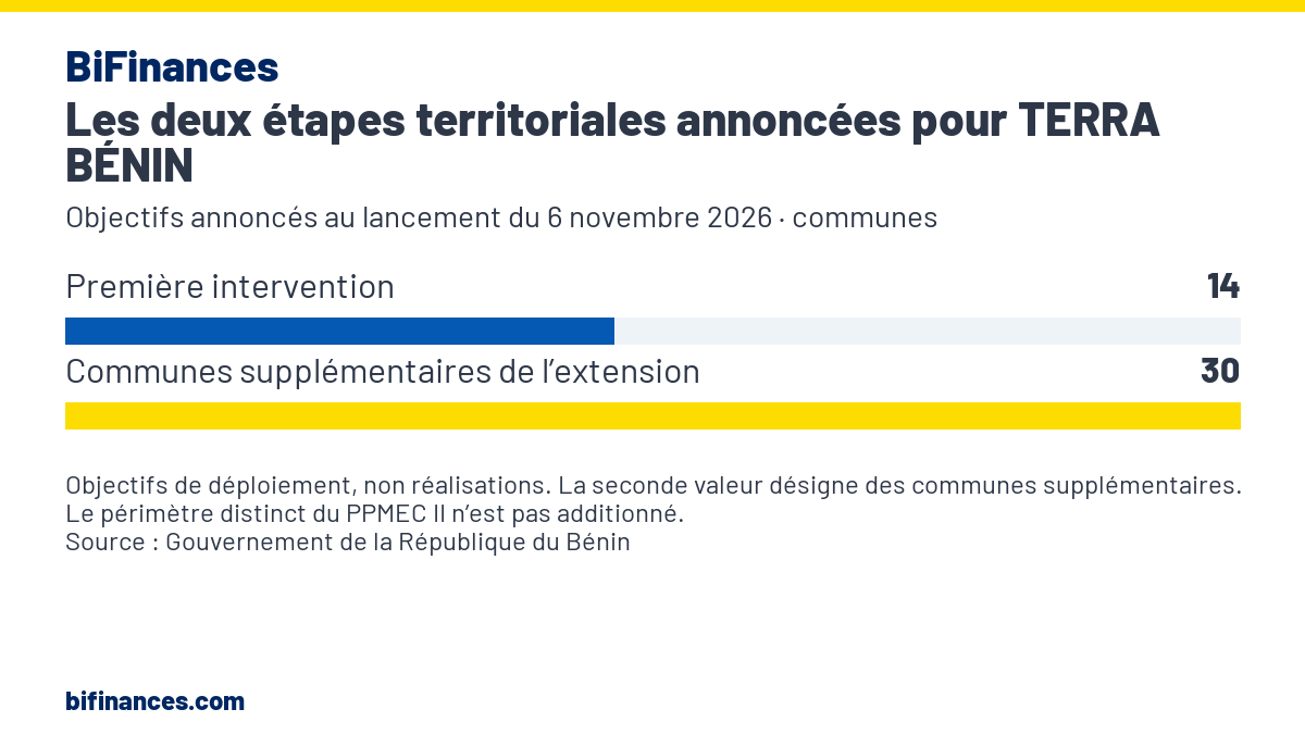
View data
| Category | communes |
|---|---|
| Première intervention | 14 |
| Communes supplémentaires de l’extension | 30 |
These operations build on interventions already under way. According to the Banouto report, the Dutch ambassador recalled at the launch the achievements of Dutch support since 2018-2019, including cadastral coverage of Cotonou, Parakou and Porto-Novo and the surveying of around 644,000 plots.
Digital services still to be improved
The geographical expansion is accompanied by work on service operations. The TERRA BÉNIN baseline assessment, dated December 2025 and available from ANDF, noted unstable internet connections, insufficient equipment and uneven command of digital tools by staff. It also flagged delays in transmitting files and insufficient coordination between communes and the agency.
This earlier assessment highlighted another monitoring difficulty. The available data on formal transactions did not allow distinct users to be counted, as a single owner could hold several plots. The study notably recommended improving data quality and performance monitoring.
The launch therefore comes on an existing framework, whose programmes are expected to extend coverage and improve use. PPMEC II provides for strengthening institutional and municipal capacities, while TERRA BÉNIN lists improving land services among its priorities.